Map4Nepal@Stanford Resources
A link page for humanitarian mapping resources in response to the Nepal Earthquake
This page is intended to be a place for me to put links to the resources I am paying attention to and using as I help volunteers at Stanford do humanitarian mapping in response to the Nepal Earthquake. If you find it useful, that's great. It's not authoritative, comprehensive or static.
Email me at stacemaples@stanford.edu if you need to.
Mapping4Nepal@Stanford Introductory Workshops
I'll be updating this page as I schedule new workshops to introduce volunteers to the basics of using the Humanitarian OpenStreetMap Task Manager and Tomnod to contribute to relief mapping for Nepal.
We are presenting Introduction to OpenStreetMap.org Relief Mapping for Nepal training sessions on the following schedule:
Friday, May 8th, from 2pm to 3pm
at the Stanford Geospatial Center Teaching Corner in Branner Earth Science Library. Please RSVP at this link: https://www.eventbrite.com/e/friday-map4nepal-introduction-to-openstreetmap-and-relief-mapping-tickets-16847646765
Anyone with a laptop and spare time is welcome to come to the Library and any of the Introductory Relief Mapping sessions I will be holding. You do not need to be a Stanford Affiliate! If you are not a Stanford affiliate, we can connect you to the Stanford Guest WiFi to work on relief mapping, or participate in the workshops.
Stanford Geospatial Center Teaching Corner Map4Nepal@Stanford Co-location & Support
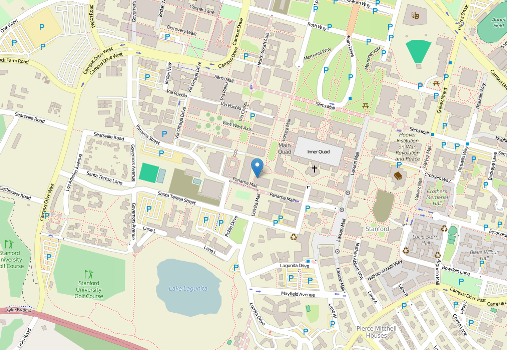
The Stanford Geospatial Center Teaching Corner has been reserved for the week of April 26th - May 1st for those who are interested in contributing to mapping efforts for disaster relief, in Nepal. The Stanford Geospatial Center Teaching Corner is located in the Northwest Corner of the Mitchell Earth Science Building, on the 2nd floor, in the Branner Earth Sciences Library. If You need assistance getting started, and can't make one of the Workshops, please come by my office and I will get you pointed in the right direction.
Here is a map: http://www.openstreetmap.org/?mlat=37.42656&mlon=-122.17287#map=19/37.42656/-122.17287
Please note that food is not allowed in the library facilities, but drinks in spill-proof containers are acceptable.
Teaching Corner Hours:
Monday - Thursday: 9am - 9pm
Friday 9am - 5pm
Mapping4Nepal@Stanford Introductory Workshops
I'll be updating this page as I schedule new workshops to introduce volunteers to the basics of using the Humanitarian OpenStreetMap Task Manager and the Tomnod to contribute to relief mapping for Nepal.
Basic Information for Contributing RIGHT NOW
Working on OpenStreetMap Tasks
General Info on the OSM Humanitarian Mapping effort: http://wiki.openstreetmap.org/wiki/2015_Nepal_earthquake
If you want to contribute IMMEDIATELY to ongoing Humanitarian Mapping efforts for Nepal through Humanitarian OpenStreetMap.org, please do the following:
First go through the 30 minute training on http://mapgive.state.gov to learn the basics of humanitarian mapping using OpenStreetMap.org
Then go to the HOTOSM Task Manager at http://tasks.hotosm.org/ and select a job that you feel comfortable contributing to. Read the directions carefully for the job, then select one of the squares next to one that is marked as complete. This will allow you to pan to the completed square so you can see how others are digitizing the features and mimic their work.
It doesn't matter how long you work, or how many features you digitize. There are currently hundreds of people mapping on HOTOSM for the Nepal Earthquake.Every edit counts.
Additional Tutorials and HOTOSM Resources
-
For examples of Before and After Earthquake Damage Assessments from Satellite Imagery
http://unosat-maps.web.cern.ch/unosat-maps/NP/EQ20150425NPL/UNOSAT_Nepal_20150427_v1.pdf -
Guidance for Mapping IDP (Internally Displaced People) Camps in the Nepal HOTOSM Tasks
http://hotosm.github.io/tracing-guides/guide/Nepal.html
- OpenStreetMap Wiki Nepal Remote Mapping Guide This guide has image examples VERY HELPFUL!: http://wiki.openstreetmap.org/wiki/Nepal_remote_mapping_guide
Assessing Damage with Tomnod
You can also help assess damage, as new imagery becomes available. See this DigitalGlobe post for information:
Data Sources
Obtaining the latest OSM Data for use in Relief Efforts
If you are a responder, or working with any organization that needs the most up-to-date geodata for the region, a consulting company called Geofabrik has set up a download site for OSM data that will be updated every 30 minutes throughout the HOTOSM activation. Find the data in various formats (including Garmin, Shapefile, etc...) here: http://labs.geofabrik.de/nepal/
Google Media Alert: New Satellite Imagery of Kathmandu and more... https://groups.google.com/forum/#!topic/google-media-updates/3MwXYXizpnc
Access DigitalGlobe Imagery for Nepal: http://www.digitalglobeblog.com/2015/04/26/digitalglobe-opens-access-to-satellite-data-to-support-disaster-response-efforts-in-nepal/
General Information Resources

http://web.stanford.edu/~maples/images/VIIRS_DNB_Nepal_Region_2015-115.png
Humanity Road Situation Reports: http://humanityroad.org/apr25nepalquake/?utm_content=buffer83b77&utm_medium=social&utm_source=twitter.com&utm_campaign=buffer Aggregator for current needs and on-the-ground situation reports.
Google's Person Finder for Nepal Earthquake: http://google.org/personfinder/2015-nepal-earthquake
USHAHIDI Clearinghouse list for various Digital Volunteer Opportunities: http://www.ushahidi.com/2015/04/25/supporting-online-volunteer-response-to-the-nepal-earthquake/
IMPACTS OF POTENTIAL SEISMIC LANDSLIDES ON LIFELINE CORRIDORS Final Report SPR 740 (Landslide vulnerability models) http://www.oregon.gov/ODOT/TD/TP_RES/docs/Reports/2015/SPR740SeismicLandslides.pdf